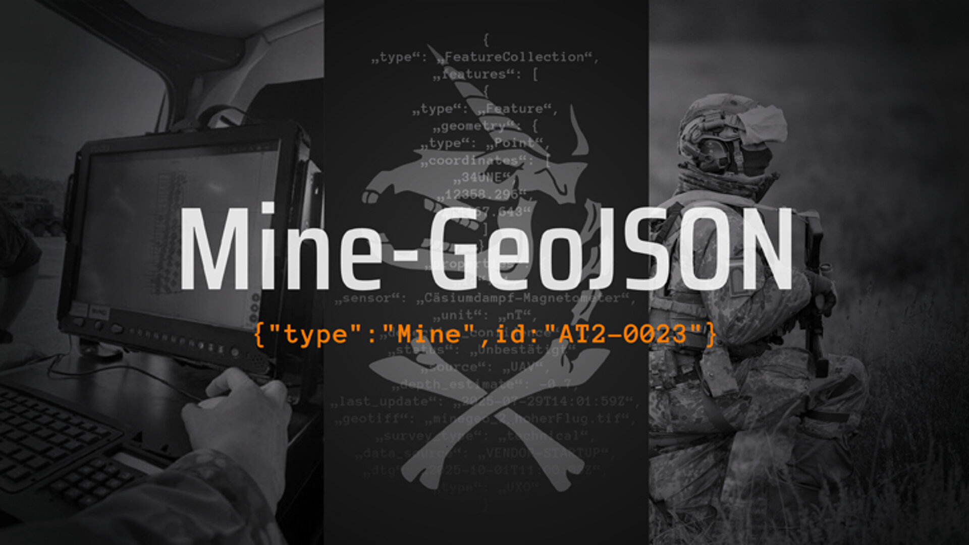
This is exactly where Mine-GeoJSON comes in. The manufacturer-independent, open standard enables the digital recording and transmission of data from explosive ordnance detection. The vision: all sensors, whether drones, vehicles or portable devices, speak the same data language. Measurement results can be imported directly into digital command and control systems such as SitaWare Frontline without conversion. Mine-GeoJSON thus becomes a central component of Software Defined Defence, a defence architecture in which the performance of a system is determined not only by its hardware, but also by its software integration.
→ More details can be found in the freely available manual on GitHub:
From concept to operational standard
Mine-GeoJSON was developed with a clear goal in mind: to create an open, vendor-independent standard that structures data from explosive ordnance detection in such a way that it is immediately ready for use. Its creation was only possible because different players contributed their specific expertise.
- As the Bundeswehr Cyber Innovation Hub (CIHBw), we took on the role of catalyst.
We identified the problem of fragmented data, brought the right partners together and actively drove development forward. - The airborne engineers provided the direct operational relevance. Their experience from real-world operations defined the requirements that Mine-GeoJSON must meet in practice.
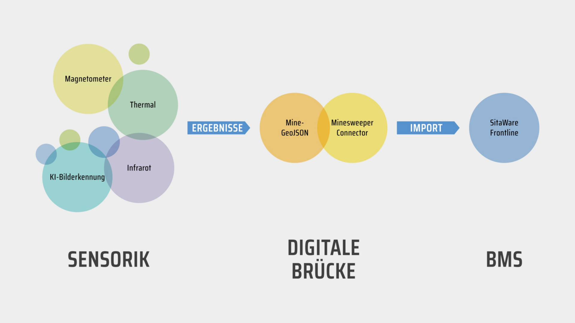
- The start-up ASDRO GmbH provided a drone with an integrated magnetic sensor, whose measurement data was recorded in the new format.
- Bootcamp Bros. developed the ‘Minesweeper Connector,’ which automatically reads Mine-GeoJSON data and transfers it directly to the SitaWare Frontline mission control system.
This combination of operational relevance, start-up speed, and innovative spirit made it possible to translate the standard from concept to practice in a very short time.
The initial tests were successful:
- An ASDRO drone detected mine signatures from the air.
- The data was stored in Mine GeoJSON format.
- The Minesweeper Connector imported this data and immediately displayed it in the situation overview.
The result: no manual data conversion, a uniform structure for all parties involved and cross-domain usability – practical proof that interoperability in explosive ordnance detection is no longer a vision, but reality.
Reality of deployment before Mine-GeoJSON
Experience from a defence exercise shows how barriers were previously created and transferred to the situation picture:
- Manual surveying and documentation of barriers
- Manual insertion of military symbols into map overlays
- Manual recording of barrier positions, where even a single transposed digit can lead to deviations of up to 50 metres between the reported and actual barrier position
- Transfer of information via a multi-stage process (pencil - paper - report)
- Several hours spent solely on transferring this critical information to the situation picture
The conlcusion from the exercise:
With a standard such as Mine-GeoJSON, closure plans can be transferred to the situation picture much more quickly and accurately, significantly reducing the workload for the engineers.
Why this is a game changer
Mine-GeoJSON addresses several key challenges at once:
- Interoperability: Partner nations, task forces and manufacturers work on the basis of the same data structure.
- Efficiency: Less time spent on preparation, more time for analysis and decision-making.
- Future-proofing: The open standard can be expanded at any time to include new fields, sensors and scenarios.
Especially in the context of alliance defence, a faster flow of information can save lives in an emergency.
Clear orientation for start-ups
Until now, there have been no binding guidelines for start-ups in the field of explosive ordnance detection on how measurement results should be structured, processed and transferred. This has led to uncertainty and meant that technological advances have often not been fully exploited.
Mine-GeoJSON provides clarity in this area. Manufacturers and developers now know from the outset which data fields and structures are required in a military context. This prevents innovations from being slowed down by interface problems and enables the start-ups' technological edge to be immediately effective in the field.
With the successful practical tests, the next step is clear: Mine-GeoJSON will be made freely accessible. Every manufacturer, every start-up and every organisation working in the field of explosive ordnance detection can now use the standard and integrate it into their own systems.
We are deliberately publishing the manual for this on GitHub: github.com/cyberinnovationhub/Mine-GeoJSON
This means that everyone – from developers and deployment planners to international partners – has access to the latest version at all times, including new additions and improvements.
The GitHub page contains:
- the complete specification of the format
- practical examples of implementations
- information on integration into existing systems
The path to this standard shows how innovation arises: start-ups bring speed and the courage to experiment, military units provide operational reality, and the CIHBw connects both worlds. This synergy is at the heart of Software Defined Defence and the reason why Mine-GeoJSON became a reality so quickly.
Forecast: From the pilot phase to deployment
The goal is clear: finalise the plugin for the German Armed Forces and make it available for use.
At the same time, we invite international partners and industry to integrate Mine-GeoJSON into their systems.
Alliance defence only works when technology, standards and people work together seamlessly.
Mine-GeoJSON lays the foundation for this and remains up to date on GitHub as a central reference.